
'Digital twin' to help develop Australian cities
Georgia Fryer
CSIRO technology uses 3D and 4D data to visualise and develop cities.
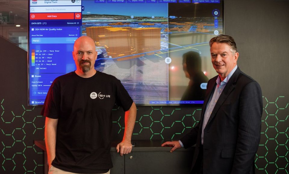
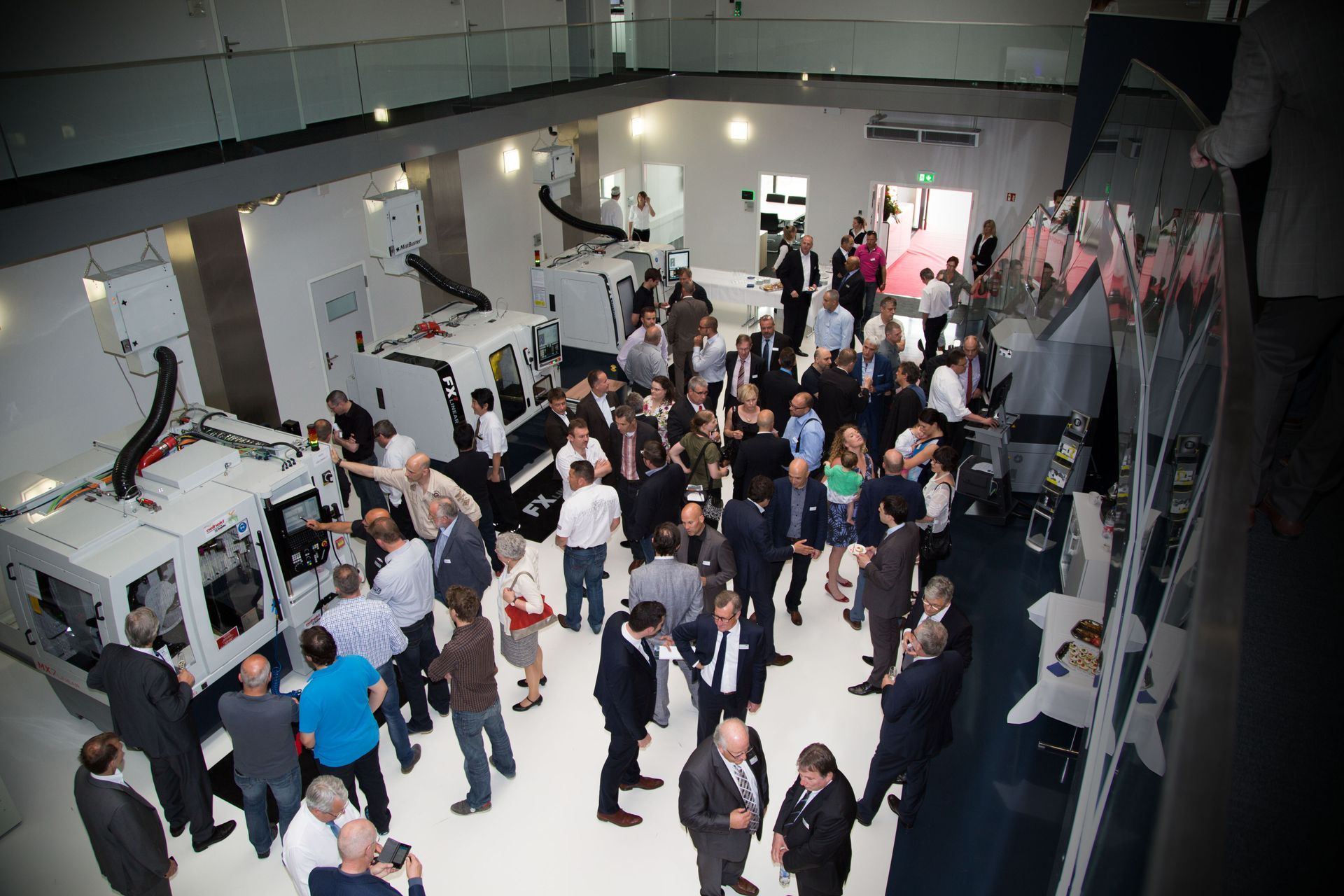
CSIRO’s Data61 has developed the NSW Spatial Digital Twin, which provides a virtual 4D (3D and time) model, currently, of Western Sydney’s built and natural environment.
The Digital Twin is an open platform that can visualise buildings, strata plans, terrain, property boundaries, utilities and sewer pipes in three dimensions over time.
The technology collects data from governments, industry, and previous digital twins and geographic systems to create an interactive live data sharing, collaboration and visualisation tool that models the urban environment.
This previously inaccessible data is federated to ensure all users are working off the same data, allowing them to effectively respond to different built and natural environments.
The platform also integrates Digital Engineering assets, Building Information Models, and live API feeds for public transport, air quality, and energy production, according to DCS Spatial Services.
Simon Barry, acting director of Data61, said the new visualisation brings together world-leading expertise in spatial visualisation, analytics and privacy preserving technologies.
“By partnering with government and industry across the country, we can harness their technologies into a federal collaboration platform enhancing Australia’s smart cities and delivering significant benefit to Australia’s economy,” he said.
By viewing this data together, the technology helps planners, developers and policymakers to gain a broader understanding of current landscapes and the impacts of new developments on the communities, allowing them to make more informed decisions, saving costs and creating efficiencies.
“Until now, decision makers have referred to property boundaries in 2D. Having them available in 3D together with how they have changed over time, and being able to easily share this with other related data makes it much easier to fully understand the context of the boundaries,” Mats Henrikson, Geospatial Web Systems Group Leader at Data61, said.
“Cities are data rich as a result of connected sensors. This creates incredible opportunities to overlay 3D/4D data from satellite and drone technologies which is spatially accurate, to show the bigger picture of what’s happening above and below the ground,” he explained.
The technology will also enable governments to better communicate plans for infrastructure development to citizens.
Currently, the NSW Spatial Digital Twin offers an online version of Western Sydney, mapping 22 million trees with height and canopy attributes, over 500,000 buildings, 20,000km of 3D roads, 7,000 3D strata plans. This puts the visualisation of historical data alongside real-time visuals before construction begins.
Future phases of the digital twin will include other areas of Sydney visualised through the technology.
Most of the data is available to the public online, however its built-in security features ensure authorised individuals have access to certain types of data.
Getting asked what we look for in deals is one of the most common questions I get as an investment manager.

The Small Business Association of Australia is dedicated to supporting SMEs, acting as their voice to government and helping them connect, grow, and prosper well into the future.

Sensibles may sound like science fiction, but this revolutionary technology is making waves in aged-care facilities, and has the potential to transform health monitoring at scale.

Alice Springs and the deserts of Central Australia don’t sound like a food basket, but they are for businesswoman and bush foods innovator Rayleen Brown.
A new report aims to lay the foundations for a deeper and more meaningful and equitable relationship between Indigenous and non-Indigenous Australians in the mining transition sector.

If the health and medical research sector in Australia is to move forward, it must address gender equity, diversity, and inclusion- which means making the sector a safe and inclusive workspace for all.
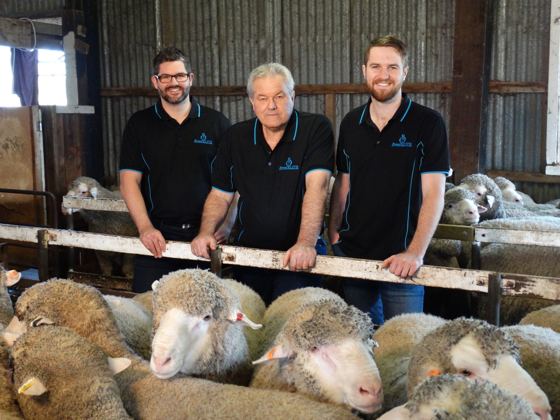
A ground-breaking sheep technology system is bettering the businesses and lives of Australian sheep breeders thanks to a revolutionary combination of software, hardware, and support never before combined into one cohesive unit.
ANCA took an early view to look beyond Australia’s shores whilst developing advanced manufacturing technologies now viewed as ‘business as usual’
As Australia grapples with a critical skills shortage, many are now encouraging young people to embrace a career in the trades, where a wealth of opportunities awaits.

In 2016 I published a blog article titled Moonshots for Australia: 7 For Now. It’s one of many I have posted on business and innovation in Australia. In that book, I highlighted a number of Industries of the Future among a number of proposed Moonshots. I self-published a book, Innovation in Australia – Creating prosperity for future generations, in 2019, with a follow-up COVID edition in 2020. There is no doubt COVID is causing massive disruption. Prior to COVID, there was little conversation about National Sovereignty or supply chains. Even now, these topics are fading, and we remain preoccupied with productivity and jobs! My motivation for this writing has been the absence of a coherent narrative for Australia’s business future. Over the past six years, little has changed. The Australian ‘psyche’ regarding our political and business systems is programmed to avoid taking a long-term perspective. The short-term nature of Government (3 to 4-year terms), the short-term horizon of the business system (driven by shareholder value), the media culture (infotainment and ‘gotcha’ games), the general Australian population’s cynical perspective and a preoccupation with a lifestyle all create a malaise of strategic thinking and conversation. Ultimately, it leads to a leadership vacuum at all levels. In recent years we have seen the leadership of some of our significant institutions failing to live up to the most basic standards, with Royal Commissions, Inquiries and investigations consuming excessive time and resources. · Catholic Church and other religious bodies · Trade Unions · Banks (and businesses generally, take casinos, for example) · the Australian Defence Force · the Australian cricket teams · our elected representatives and the staff of Parliament House As they say, “A fish rots from the head!” At best, the leadership behaviour in those institutions could be described as unethical and, at worst….just bankrupt! In the last decade, politicians have led us through a game of “leadership by musical chairs” – although, for now, it has stabilised. However, there is still an absence of a coherent narrative about business and wealth creation. It is a challenge. One attempt to provide such a narrative has been the Intergenerational Reports produced by our federal Government every few years since 2002. The shortcomings of the latest Intergenerational Report Each Intergenerational Report examines the long-term sustainability of current government policies and how demographic, technological, and other structural trends may affect the economy and the budget over the next 40 years. The fifth and most recent Intergenerational Report released in 2021 (preceded by Reports in 2002, 2007, 2010 and 2015) provides a narrative about Australia’s future – in essence, it is an extension of the status quo. The Report also highlights three key insights: 1. First, our population is growing slower and ageing faster than expected. 2. The Australian economy will continue to grow, but slower than previously thought. 3. While Australia’s debt is sustainable and low by international standards, the ageing of our population will pressure revenue and expenditure. However, its release came and went with a whimper. The recent Summit on (what was it, Jobs and Skills and productivity?) also seems to have made the difference of a ‘snowflake’ in hell in terms of identifying our long-term challenges and growth industries. Let’s look back to see how we got here and what we can learn. Australia over the last 40 years During Australia’s last period of significant economic reform (the late 1980s and early 1990s), there was a positive attempt at building an inclusive national narrative between Government and business. Multiple documents were published, including: · Australia Reconstructed (1987) – ACTU · Enterprise Bargaining a Better Way of Working (1989) – Business Council of Australia · Innovation in Australia (1991) – Boston Consulting Group · Australia 2010: Creating the Future Australia (1993) – Business Council of Australia · and others. There were workshops, consultations with industry leaders, and conferences across industries to pursue a national microeconomic reform agenda. Remember these concepts? · global competitiveness · benchmarking · best practice · award restructuring and enterprising bargaining · training, management education and multiskilling. This agenda was at the heart of the business conversation. During that time, the Government encouraged high levels of engagement with stakeholders. As a result, I worked with a small group of training professionals to contribute to the debate. Our contribution included events and publications over several years, including What Dawkins, Kelty and Howard All Agree On – Human Resources Strategies for Our Nation (published by the Australian Institute of Training and Development). Unfortunately, these long-term strategic discussions are nowhere near as prevalent among Government and industry today. The 1980s and 1990s were a time of radical change in Australia. It included: · floating the $A · deregulation · award restructuring · lowering/abolishing tariffs · Corporatisation and Commercialisation Ross Garnaut posits that the reforms enabled Australia to lead the developed world in productivity growth – given that it had spent most of the 20th century at the bottom of the developed country league table. However, in his work, The Great Reset, Garnaut says that over the next 20 years, our growth was attributable to the China mining boom, and from there, we settled into “The DOG days” – Australia moved to the back of a slow-moving pack! One unintended consequence of opening our economy to the world is the emasculation of the Australian manufacturing base. The manic pursuit of increased efficiency, lower costs, and shareholder value meant much of the labour-intensive work was outsourced. Manufacturing is now less than 6% of our GDP , less than half of what it was 30 years ago!